Disclaimer: no hypothermia was contracted in the making of this post
Day 1/June 8
Arcata to Rattlesnake Ridge
45 miles
Total So Far: 45 miles
In the end, I decide not to bike into Arcata to get a grandiose starting photo at the Los Bagels store there, whosekind of good for the West Coast Bagels I fixated on during the three years in which I went to Humbolt with any sort of regularity. Adam Wagschal has ‘Los bagels’ bagels in his house anyway, and he makes me delicious eggs to see me off. I couldn’t have asked for a better host.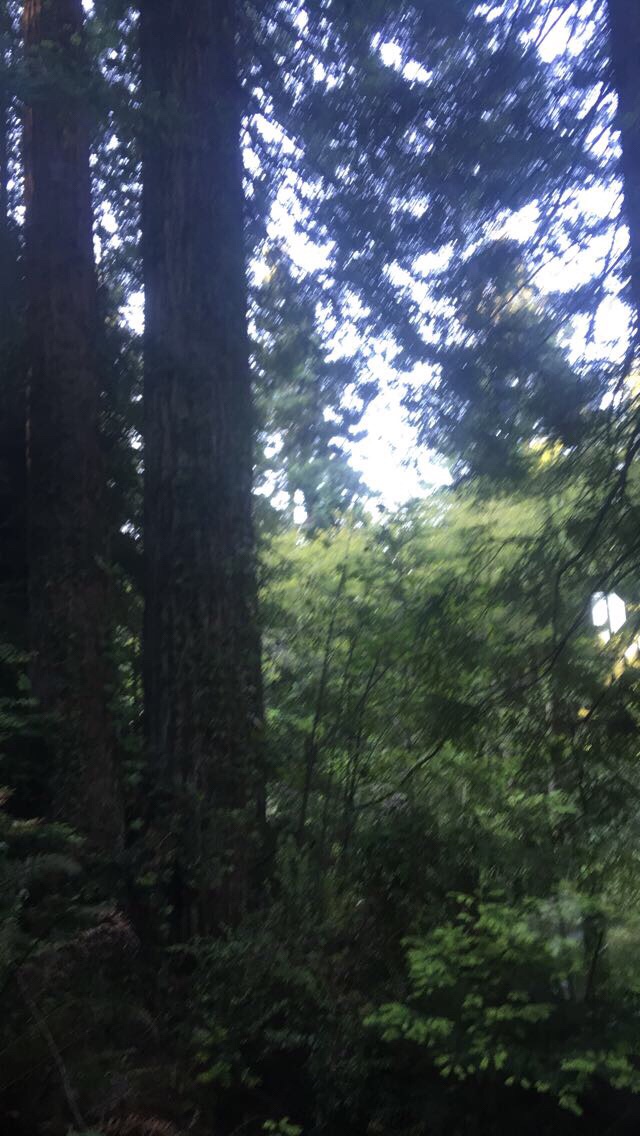
I get a starting photo in Adam’s driveway, but I’m making one of those awkward i-want-this-photo-to-be-over faces and I leave right after posting it to Instagram, bike down the steepest hill in Arcata and then turn up another road that leads up another very steep hill. 
This is he edgeof town, with the kind of houses whose backyards open on old growth redwood forest, and it feels like I’ve been plucked from sedentariness into the middle of along journey through the woods even in the first few minutes. 
And these hills are steep. I don’t realize how slow I’m going until I’m an hour past the Arcata City limits, still making my way up the same hill I left town on—Fickle Hill—and I check my phone to discover I’ve covered the first 4 miles out of an expected 1,100. This really is going to be harder than I thought it would be. After the initialed reawakening to bicycle touring, Fickle Hill Road begins to undulate almost gently along a meadowy ridge, though it still trends nauseatingly up. 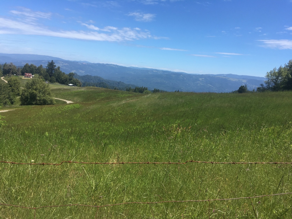
There are goat farms up here, wildflowers, green stretches of meadow, and now that I’m above the trees I can see out to the bulbous blue splotch of Humbolt Bay and the narrow strip of dunes deprecating it from a massive ocean. The towns of Eureka and Arcata splay upwards into low forested hills, their boxy white house set against an incessant tapestry of rolling dark green. To the east, the heavy massiff of South Fork Mountain takes up the land beyond another narrow wooded valley and the Kings Range glitters faraway and blurry to the southwest. The view looks like the ethereality I envisioned before getting here, but the hills are still hills and I am still laughably out of shape. 
I spend most of the morning either on or between ridges along narrow empty mostly paved roads whose builders must have been given a maximum amount of concrete to work with. Even on the ridges, the roads refuse to stay flat or gentle—they hurdle sickeningly steeply up or down, towards cold grassy summits or narrow forested canyons marked by slow, shallow creeks.I eat lunch next to one of them, filter water, and try to swim but then remember that it’s hard to swim in six inch deep water. Instead, I lie in the sun for twenty minutes reading, trying not to think about the fact that it’s already one o’clock and I’;ve biked all of fifteen miles. When’s the last time I got to do that? Aren’t I supposed to be on vacation?
After lunch, I turn east. The pavement gives way to crumbling gravel and I follow a series of steep dirt roads up steep hills deeper into the thick forest. 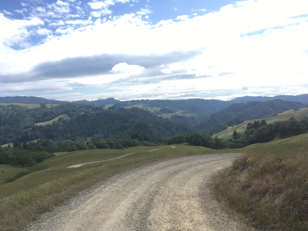
The warmth of earlier is draining slowly, and heavy storm clouds—rain predicted tonight—hang on the periphery, over South Fork Mountain. AT&T reception gives way, and I slide my phone onto airplane mode. Alone. Alone with the woods and trees and grass and cows and really steep hills. Humbolt County seems to lack any notablestretches of flat ground.
Also there’s the issue of me making really stupid first-day mistakes, like seeing that there are hella creeks and not thinking to filter until I’m almost out of water and halfway up a long waterless climb to a long waterless ridge and Ifeel hot, sweaty, there’s no way I’ll make it, I’ll dehydrate or whatever but of course I make it and fill my water bottles at the other side of the ridge. By now it’s about 4:30 and even though it’s no longer remotely hot I decide my clothes and body are so sweaty that I should bathe in the creek which is really fucking cold and leaves me shivering uncontrollably the whole time I’m filtering water.
Once I get back onto my bike the temperature’s dropped to the point of being cold, but I don’t want to dig out my warm gear so I just bike faster, up the next hill. Google Maps voice directions does that thing it likes to do sometimes where it just stops giving voice directions and I end up at the top of a very steep hill that I did not need to go up at all around six o’clock. My grand plan to reach Mad River in time to eat a veggie burger at the Mad River Burger Barn is dwindling to the point of being impossible, but maybe I’ll at least make it to Dinsmore. I just have twelve miles left and a good chunk of them should be downhill.
Once I find the right road, I start noticing that all the trees are tacked with ‘no trespassing’ signs and that the road is really just a cow track through tall grass, but Google Maps says this is Rattlesnake Ridge Road and so it must be and I bike until I reach a gate that is definitely locked and marked with a myriad of really inignorably ominous No Tresspassing Signs. 
This is Humbolt County, the highest concentration of weed grows in the state and even now that they’re legal most growers still shoot trespassers because of the high amount of cash they have to carry. And some of the grows kidnap people and force them to do manual labor. And even though it’s not probable that I would get shot or kidnapped if I trespass I start freaking out—the only way around would be to ride all the way back practically too Arcata and ride a long way on a busy, shoulderless highway. Implausibly, this gate is also the only place east of Kneeland Ridge that has At&T reception, so I post about my dilemma to Instagram and Snapchat and then call a couple of my friends who are both high and not very helpful and then call my parents.
There’s no real good option. I barely have enough time to complete the first leg and get back to Berkeley as it is and with a seventy mile detour who knows. I could take a bus. Or I could wait here and see if the property owner appears and givers me permission to cross. It’s already 7:30 so I set up camp and do the latter. Now that I’m not biking or panicking I can finally post attention to how fucking cold it is and quickly put on every article of clothing I brought.The weather app says that it’s 50 degrees, that a low of 35degrees is expected. Well. I’ll be warm in my sleeping bag, won’t I? And I’ll be dry under the tarp i brought—the fog has already descended upon the meadow facing the gate, and rain it’s predicted to be only minutes away.
I have never used a tarp tent before and do not have the faintest idea how to. Sure, theoretically the directions say to secure four ends to stakes and two ends to higher tree branches but the directions don’t tell you that the string is about eight hundred yards long and all tangled up in an untangleable ball at the bottom of the stuff sack. I decide that since the tarp is made of waterproof material, it should work effectively laid on top of my sleeping bag like a blanket and do so. Right as I’m about to go to sleep, I hear the first drops of rain—soft on the tarp and maybe the sleeping bag but I can’t feel them. Everything should be fine. If I don’tt find the property owner I’ll just suck it up and go back. I have plenty of food and there’s a store in Dinsmore anyway. I fall asleep within minutes.
